
Kösedere Village, Ayvacık – Çanakkale
Kösedere: A Living Village with a Long Memory
Kösedere is a long-established rural village in the Ayvacık district of Çanakkale Province, located slightly inland from the Aegean coast and close to Tavaklı İskelesi. Though modest in size, the village has historically been one of the more active and organised settlements in this part of the region, serving as a local centre for agriculture, trade and everyday village life.
Kösedere has never been a large town, yet it has always played an important role within its surrounding countryside. Its continued vitality — visible in its services, weekly market and social spaces — sets it apart from many villages that have experienced decline. Today, Kösedere remains very much a living village, shaped by tradition but firmly rooted in the present.
The Old Village Centre and Historic Buildings
The historic core of Kösedere lies around its old village centre, where the village’s Ottoman-period heritage is most clearly expressed.
The Old Mosque (Ottoman Period)
One of the most important heritage buildings in Kösedere is the old village mosque, located within the village boundaries in Ayvacık district, Çanakkale Province. According to the sign above the mosque entrance, the building was constructed in 1874.
Architecturally, the mosque is rectangular in plan with a pitched roof, a form typical of rural Ottoman mosques. It has a minaret built of neatly cut stone, reflecting the quality of workmanship and the importance of the structure at the time it was built.
The mosque is surrounded by a small cemetery consisting of a single grave. Although the inscription on the tombstone is now unreadable due to being painted over, the recorded date is 1025 AH (1616 AD). This earlier date suggests that the site itself may have had religious or communal significance long before the present mosque was constructed, possibly replacing an earlier structure.
The mosque was damaged during the 2017 Ayvacık earthquakes, which affected many historic buildings across the region. Since then, extensive restoration work has been carried out to return the mosque to its former appearance. The exterior restoration has been completed, and the building now stands structurally sound.
At present, the mosque remains locked and not in active use, as interior restoration work has yet to be completed.
In recognition of its historical and architectural importance, the old mosque has been placed under an official protection order, ensuring its preservation for future generations.
The New Mosque (Kösedere Köy Camii)
To meet the needs of a modernising community, construction of the Kösedere Köy Camii began in 1996 and was completed in 2010.
The mosque is well sized for a village community, offering ample space for worship while remaining in harmony with its rural setting. The interior is particularly striking, featuring stained glass windows, fine tiling and richly coloured carpets. The quality and scale of the interior decoration give the impression of a building designed for a city rather than a small village, reflecting the pride and collective effort of the local community over many years.
Today, the new mosque serves as the active religious and communal centre of Kösedere, while the historic Ottoman mosque stands preserved as a protected cultural monument.
The Ottoman Hamam
Near the old village centre are the remains of an Ottoman-period hamam (public bath). Although no longer standing in working condition, its presence is highly significant. Hamams were not built in small or insignificant settlements, and this structure indicates that Kösedere once supported a larger population and a more important local role during the Ottoman period.
The hamam would have served not only villagers but also people from nearby farms and hamlets, reinforcing Kösedere’s position as a local centre of daily life and social interaction.
The Lake and the Agricultural Landscape
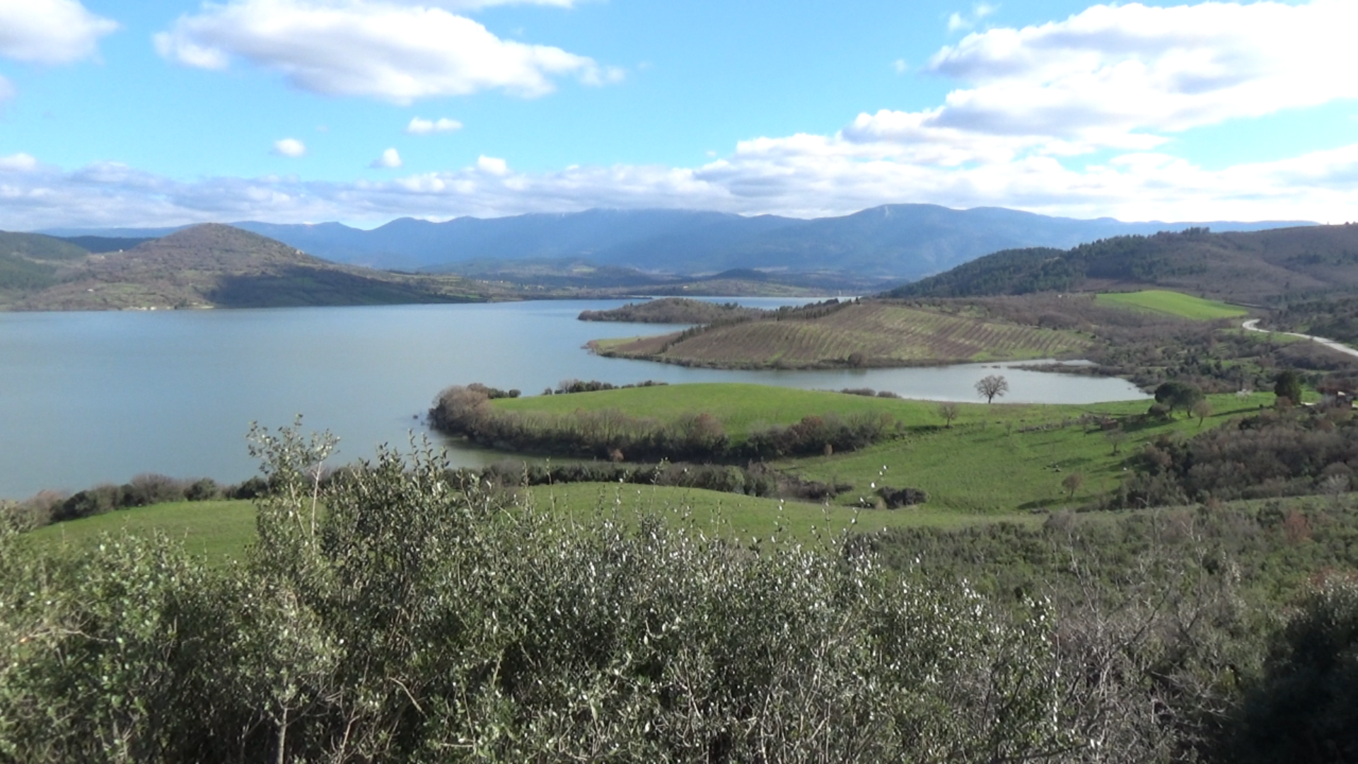
Just outside the village lies a small lake or reservoir, originally created to support irrigation and agricultural activity. While practical in origin, it has become one of the most scenic features of the Kösedere landscape.
During the summer months, it is possible to walk to the lake directly from the village, crossing farmland and open countryside. In the winter months, access is best by road due to wetter ground and seasonal conditions. This short journey is well worth the effort, offering spectacular views across the lake towards Kösedere. From this vantage point, the village appears framed by low hills, with the mosques visible between the slopes, creating a particularly striking and memorable scene.
The surrounding land — olive groves, vegetable fields and grazing areas — explains why Kösedere has remained continuously settled for centuries. The agricultural landscape visible today closely resembles that worked by earlier generations.
Local Economy, Saturday Market and Daily Life
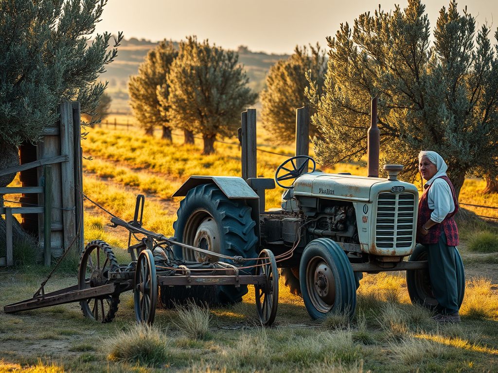
Agriculture remains the backbone of Kösedere’s economy. The village is particularly well known locally for its vegetable production, with fresh produce sold in nearby towns and markets and recognised for its quality. Olive cultivation is also central to village life, with many households producing olives and olive oil for both personal use and sale.
A defining feature of village life is the Saturday market, which brings together villagers, traders and visitors from the surrounding area. More than a place of commerce, the market is a key social gathering, reinforcing Kösedere’s role as a meeting point within the wider rural Ayvacık region.
Despite its village setting, Kösedere is well provided with everyday services:
- A health centre, offering basic medical care
- Schools, including a primary school
- Local shops and grocery stores
- Traditional tea rooms (kahvehaneler), central to daily social life
These facilities help sustain a strong sense of community and continuity.
Limantepe (Ancient Larisa): The Ancient City Beside Kösedere

Just a few kilometres from Kösedere lies Limantepe, the site of the ancient city of Larisa (Larissa of the Troad), demonstrating that this landscape has been inhabited for thousands of years.
Exact Location
- Site name: Limantepe (Ancient Larisa)
- Province / District: Çanakkale – Ayvacık
- Coordinates: 39.6156° N, 26.1453° E
- Distance from Kösedere: Approximately 3–3.5 km west / south-west
- Setting: A low coastal mound just inland from the Aegean shoreline
The name Limantepe means “Harbour Hill”, reflecting its position near what was once an ancient anchorage.
Larisa Through the Ages
Archaeological surveys indicate that Larisa was occupied from the Early Bronze Age (around 2700 BC) through the Classical, Hellenistic and Roman periods. Although never as large or powerful as Troy or Assos, Larisa formed part of the dense network of settlements that made the Troad one of the most important regions of ancient Anatolia.
The ancient city of Larisa, whose location was debated for many years, is known locally as Limantepe. In 1859, Frank Calvert—the man credited with the discovery of Troy—first presented evidence identifying Larisa with Limantepe, situated near Kösedere Village.
Heinrich Schliemann, who visited Limantepe in 1884, and the distinguished British archaeologist John M. Cook, who published his research in 1972, also supported the identification of Limantepe as ancient Larisa.
Its coastal position provided access to maritime trade, fertile agricultural land and natural resources, allowing it to function as a regionally significant settlement over many centuries.
What Can Be Seen Today
Today, Limantepe is a quiet archaeological mound rather than a developed visitor site. There are no standing monumental ruins, but the form of the hill, scattered surface finds and its strategic position clearly identify it as an ancient settlement. It is best appreciated as part of the wider cultural landscape shared with the living village of Kösedere.
A Landscape of Continuity
Together, Kösedere and Limantepe tell a story of continuity across millennia:
- Ancient settlement at Larisa
- Ottoman-era village life with mosque and hamam
- Modern rural living shaped by agriculture, markets and community
In this part of Çanakkale, history is not confined to museums — it remains embedded in the land, the buildings and the rhythms of everyday village life.
Quick Reference
Kösedere Village – Ayvacık, Çanakkale
Limantepe (Ancient Larisa) – 39.6156° N, 26.1453° E
Walk to lake (summer): possible from village
Lake access (winter): by road, scenic viewpoint
Walk to Limantepe: approx. 30–45 minutes
Drive to Limantepe: approx. 10 minutes


Leave a Reply